
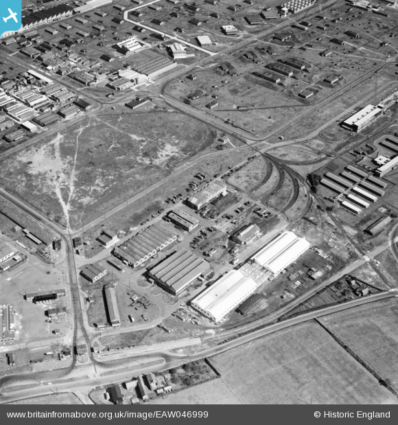
EAW046999 ENGLAND (1952). The Kirkby Industrial Estate around Cusson Road, Kirkby, 1952
© Hawlfraint cyfranwyr OpenStreetMap a thrwyddedwyd gan yr OpenStreetMap Foundation. 2026. Trwyddedir y gartograffeg fel CC BY-SA.
Delweddau cyfagos (4)
EAW046999

 0°
0m
0°
0m
EAW046997
 181°
211m
181°
211m
EAW004614
 99°
222m
99°
222m
EAW004619
 20°
237m
20°
237m
Manylion
| Pennawd | [EAW046999] The Kirkby Industrial Estate around Cusson Road, Kirkby, 1952 |
| Cyfeirnod | EAW046999 |
| Dyddiad | 7-September-1952 |
| Dolen | |
| Enw lle | KIRKBY |
| Plwyf | |
| Ardal | |
| Gwlad | ENGLAND |
| Dwyreiniad / Gogleddiad | 342822, 398041 |
| Hydred / Lledred | -2.8615912904169, 53.475735809824 |
| Cyfeirnod Grid Cenedlaethol | SJ428980 |
Pinnau
 PILLBOX: e43144 PILLBOX: e43144 |

Matt Aldred edob.mattaldred.com |
Friday 17th of July 2026 09:26:25 PM |
| ROF ordinance filling rooms spaced apart and surrounded with mounds of earth to contain the blast should an accident happen. |

Lord Axminister |
Sunday 14th of December 2025 11:21:40 PM |
| underground shelter |
austin |
Thursday 17th of September 2020 06:27:05 PM |