
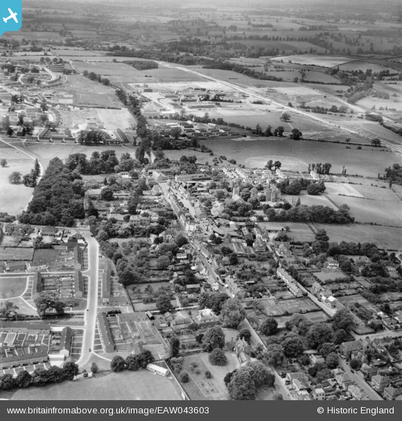
EAW043603 ENGLAND (1952). The town centre, Harlow, from the east, 1952
© Hawlfraint cyfranwyr OpenStreetMap a thrwyddedwyd gan yr OpenStreetMap Foundation. 2026. Trwyddedir y gartograffeg fel CC BY-SA.
Delweddau cyfagos (6)
EAW043603

 0°
0m
0°
0m
EAW001508
 231°
116m
231°
116m
EPW028421
 252°
126m
252°
126m
EAW043602
 62°
179m
62°
179m
EPW028423
 68°
179m
68°
179m
EPW028422
 267°
208m
267°
208m
Manylion
| Pennawd | [EAW043603] The town centre, Harlow, from the east, 1952 |
| Cyfeirnod | EAW043603 |
| Dyddiad | 4-June-1952 |
| Dolen | |
| Enw lle | HARLOW |
| Plwyf | |
| Ardal | |
| Gwlad | ENGLAND |
| Dwyreiniad / Gogleddiad | 547279, 211572 |
| Hydred / Lledred | 0.13535382441733, 51.782949518594 |
| Cyfeirnod Grid Cenedlaethol | TL473116 |
Pinnau
 Mowbray Road Mowbray Road |

steveF |
Friday 19th of March 2021 06:59:44 AM |
| Howard Way |
steveF |
Friday 19th of March 2021 06:57:40 AM |
| High Street |
steveF |
Friday 19th of March 2021 06:51:55 AM |
| First industrial units of Harlow New Town being built |
Mikeya |
Monday 18th of August 2014 07:56:58 PM |
| A414 Edinburgh Way under construction |
Mikeya |
Monday 18th of August 2014 07:56:31 PM |
| Harlow cricket club |
markmaltese67 |
Monday 18th of August 2014 02:24:44 PM |
| Harlow college |
markmaltese67 |
Monday 18th of August 2014 02:22:43 PM |
Cyfraniadau Grŵp
This is more accurately Old Harlow town centre rather than the town centre of Harlow New Town, developed some miles west. |
Mikeya |
Monday 18th of August 2014 07:57:37 PM |