
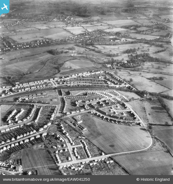
EAW041250 ENGLAND (1951). Development of housing at Creighton Avenue and environs, St Julians, 1951
© Hawlfraint cyfranwyr OpenStreetMap a thrwyddedwyd gan yr OpenStreetMap Foundation. 2026. Trwyddedir y gartograffeg fel CC BY-SA.
Delweddau cyfagos (2)
EAW041250

EAW030233

Manylion
| Pennawd | [EAW041250] Development of housing at Creighton Avenue and environs, St Julians, 1951 |
| Cyfeirnod | EAW041250 |
| Dyddiad | 14-November-1951 |
| Dolen | |
| Enw lle | ST JULIANS |
| Plwyf | |
| Ardal | |
| Gwlad | ENGLAND |
| Dwyreiniad / Gogleddiad | 515135, 205578 |
| Hydred / Lledred | -0.3324357538314, 51.736613152129 |
| Cyfeirnod Grid Cenedlaethol | TL151056 |
Pinnau
Byddwch y cyntaf i ychwanegu sylw at y ddelwedd hon!