
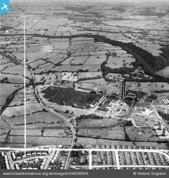
EAW038904 ENGLAND (1951). The Courtaulds Red Scar Works, Preston, from the west, 1951. This image has been produced from a print marked by Aerofilms Ltd for photo editing.
© Hawlfraint cyfranwyr OpenStreetMap a thrwyddedwyd gan yr OpenStreetMap Foundation. 2026. Trwyddedir y gartograffeg fel CC BY-SA.
Delweddau cyfagos (8)
EAW038904

EAW038905

EAW038908

EAW038907

EAW038906

EAW038911

EAW038909

EAW038912

Manylion
| Pennawd | [EAW038904] The Courtaulds Red Scar Works, Preston, from the west, 1951. This image has been produced from a print marked by Aerofilms Ltd for photo editing. |
| Cyfeirnod | EAW038904 |
| Dyddiad | 16-August-1951 |
| Dolen | |
| Enw lle | PRESTON |
| Plwyf | |
| Ardal | |
| Gwlad | ENGLAND |
| Dwyreiniad / Gogleddiad | 357463, 432193 |
| Hydred / Lledred | -2.6456595578652, 53.78410465627 |
| Cyfeirnod Grid Cenedlaethol | SD575322 |
Pinnau

Preston Digital Archive |
Tuesday 5th of December 2023 03:36:04 AM | |
|
Post-war prefabs |
Sunday 27th of September 2020 09:54:33 AM |