
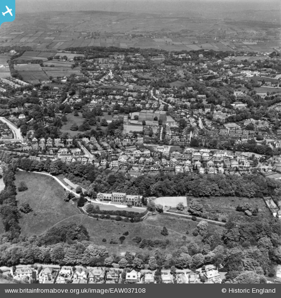
EAW037108 ENGLAND (1951). The United Sheffield Hospitals Rehabilitation Centre, the residential area at Stumperlowe and environs, Fulwood, from the south, 1951. This image has been produced from a print.
© Hawlfraint cyfranwyr OpenStreetMap a thrwyddedwyd gan yr OpenStreetMap Foundation. 2026. Trwyddedir y gartograffeg fel CC BY-SA.
Delweddau cyfagos (4)
EAW037108

 0°
0m
0°
0m
EAW037106
 288°
22m
288°
22m
EAW037105
 332°
103m
332°
103m
EAW037107
 0°
115m
0°
115m
Manylion
| Pennawd | [EAW037108] The United Sheffield Hospitals Rehabilitation Centre, the residential area at Stumperlowe and environs, Fulwood, from the south, 1951. This image has been produced from a print. |
| Cyfeirnod | EAW037108 |
| Dyddiad | 5-June-1951 |
| Dolen | |
| Enw lle | FULWOOD |
| Plwyf | |
| Ardal | |
| Gwlad | ENGLAND |
| Dwyreiniad / Gogleddiad | 431217, 385306 |
| Hydred / Lledred | -1.5308454910065, 53.363437319774 |
| Cyfeirnod Grid Cenedlaethol | SK312853 |
Pinnau
 Bomb 2 of 3. 12th Dec 1940, stick of 3 incendiary bombs. Blitz card "Sandygate Road" "opp. Pitchford Lane" Bomb 2 of 3. 12th Dec 1940, stick of 3 incendiary bombs. Blitz card "Sandygate Road" "opp. Pitchford Lane" |

Rob |
Friday 1st of May 2020 09:23:50 PM |
| Bomb 3 of 3. 12th Dec 1940, stick of 3 incendiary bombs.
Blitz card "Sandygate Road" "Junc. Coldwell Lane" |
Rob |
Friday 1st of May 2020 09:23:19 PM |
| Bomb 1 of 3 12th Dec 1940, stick of 3 incendiary bombs.
Blitz card "Sandygate Road" "150 yds away opp. Golf House." |
Rob |
Friday 1st of May 2020 09:20:56 PM |