
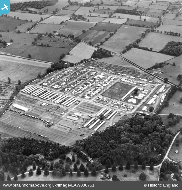
EAW036751 ENGLAND (1951). Rougham, the Suffolk County Show, 1951. This image has been produced from a print.
© Hawlfraint cyfranwyr OpenStreetMap a thrwyddedwyd gan yr OpenStreetMap Foundation. 2026. Trwyddedir y gartograffeg fel CC BY-SA.
Delweddau cyfagos (13)
EAW036751

EAW036748

EAW036747

EAW036758

EAW036770

EAW036760

EAW036749

EAW036768

EAW036771

EAW036762

EAW036753

EAW036767

EAW036752

Manylion
| Pennawd | [EAW036751] Rougham, the Suffolk County Show, 1951. This image has been produced from a print. |
| Cyfeirnod | EAW036751 |
| Dyddiad | 7-June-1951 |
| Dolen | |
| Enw lle | ROUGHAM |
| Plwyf | RUSHBROOKE WITH ROUGHAM |
| Ardal | |
| Gwlad | ENGLAND |
| Dwyreiniad / Gogleddiad | 591540, 263586 |
| Hydred / Lledred | 0.80543901804032, 52.236692519897 |
| Cyfeirnod Grid Cenedlaethol | TL915636 |
Pinnau

Matt Aldred edob.mattaldred.com |
Thursday 7th of March 2024 09:43:14 AM | |
|
Matt Aldred edob.mattaldred.com |
Friday 22nd of September 2023 05:16:45 PM |