
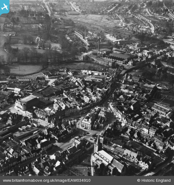
EAW034910 ENGLAND (1951). The town centre, Chippenham, 1951. This image has been produced from a print.
© Hawlfraint cyfranwyr OpenStreetMap a thrwyddedwyd gan yr OpenStreetMap Foundation. 2026. Trwyddedir y gartograffeg fel CC BY-SA.
Delweddau cyfagos (9)
EAW034910

EPW011109

EAW034912

EPW011108

EAW034909

EAW034911

EPW011114

EPW011111

EPW011106

Manylion
| Pennawd | [EAW034910] The town centre, Chippenham, 1951. This image has been produced from a print. |
| Cyfeirnod | EAW034910 |
| Dyddiad | 12-March-1951 |
| Dolen | |
| Enw lle | CHIPPENHAM |
| Plwyf | CHIPPENHAM |
| Ardal | |
| Gwlad | ENGLAND |
| Dwyreiniad / Gogleddiad | 392053, 173247 |
| Hydred / Lledred | -2.1143941016051, 51.457656669482 |
| Cyfeirnod Grid Cenedlaethol | ST921732 |
Pinnau

gBr |
Tuesday 29th of December 2015 07:30:06 PM |
Cyfraniadau Grŵp
I cannot believe how much the town centre must have changed 1951-1975. The differences are just bonkers. There's been very little major change since 1975. Okay, so Emery Gate shopping centre etc, and a lot of tarting up of existing buildings, but nothing like re-routing the river etc. |

rhodso |
Tuesday 17th of January 2017 04:57:34 AM |