
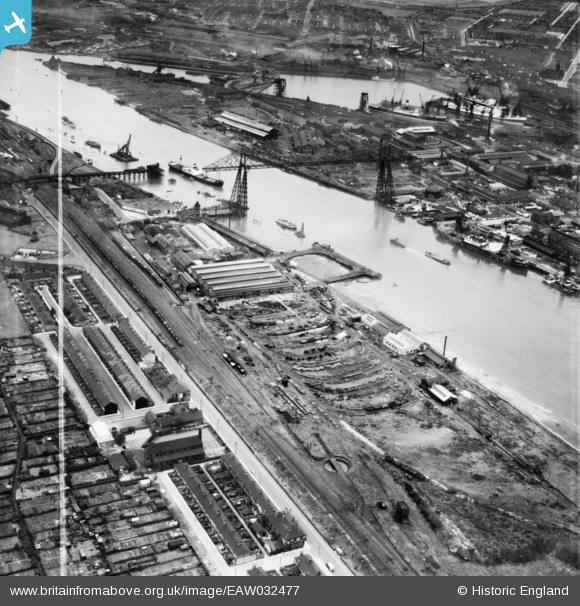
EAW032477 ENGLAND (1950). The Anderston Iron Foundry and the Tees Transporter Bridge, Port Clarence, 1950. This image was marked by Aerofilms Ltd for photo editing.
© Hawlfraint cyfranwyr OpenStreetMap a thrwyddedwyd gan yr OpenStreetMap Foundation. 2026. Trwyddedir y gartograffeg fel CC BY-SA.
Delweddau cyfagos (12)
EAW032477

EAW032482

EAW032476

EAW032484

EAW032480

EAW032481

EAW032485

EAW032483

EAW032479

EAW032478

EAW024127

EAW032536

Manylion
| Pennawd | [EAW032477] The Anderston Iron Foundry and the Tees Transporter Bridge, Port Clarence, 1950. This image was marked by Aerofilms Ltd for photo editing. |
| Cyfeirnod | EAW032477 |
| Dyddiad | 30-August-1950 |
| Dolen | |
| Enw lle | PORT CLARENCE |
| Plwyf | BILLINGHAM |
| Ardal | |
| Gwlad | ENGLAND |
| Dwyreiniad / Gogleddiad | 449873, 521524 |
| Hydred / Lledred | -1.228188216401, 54.586327672971 |
| Cyfeirnod Grid Cenedlaethol | NZ499215 |
Pinnau

J May |
Tuesday 24th of May 2016 06:37:56 PM | |
|
J May |
Tuesday 24th of May 2016 06:37:32 PM | |
|
J May |
Tuesday 24th of May 2016 06:35:26 PM | |
|
J May |
Monday 23rd of May 2016 06:07:14 PM | |
|
David Crawford |
Sunday 20th of September 2015 12:02:30 AM |