
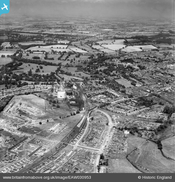
EAW030953 ENGLAND (1950). The Gas Works, Abbey Station the area around Sotwell Nunnery, St Albans, from the south-east, 1950
© Hawlfraint cyfranwyr OpenStreetMap a thrwyddedwyd gan yr OpenStreetMap Foundation. 2026. Trwyddedir y gartograffeg fel CC BY-SA.
Delweddau cyfagos (4)
EAW030953

EAW041251

EAW030951

EAW030232

Manylion
| Pennawd | [EAW030953] The Gas Works, Abbey Station the area around Sotwell Nunnery, St Albans, from the south-east, 1950 |
| Cyfeirnod | EAW030953 |
| Dyddiad | 13-July-1950 |
| Dolen | |
| Enw lle | ST ALBANS |
| Plwyf | |
| Ardal | |
| Gwlad | ENGLAND |
| Dwyreiniad / Gogleddiad | 514956, 205967 |
| Hydred / Lledred | -0.33489858759174, 51.74014636542 |
| Cyfeirnod Grid Cenedlaethol | TL150060 |
Pinnau

Sandyn |
Saturday 21st of August 2021 04:48:22 PM |