
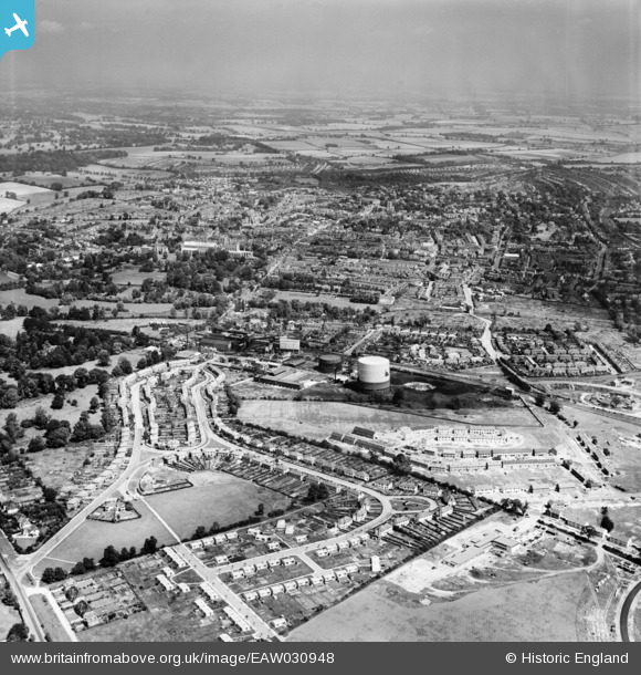
EAW030948 ENGLAND (1950). The Gas Works, Tavistock Avenue and the city, St Albans, from the south, 1950
© Hawlfraint cyfranwyr OpenStreetMap a thrwyddedwyd gan yr OpenStreetMap Foundation. 2026. Trwyddedir y gartograffeg fel CC BY-SA.
Delweddau cyfagos (3)
EAW030948

EAW030231

EAW041252

Manylion
| Pennawd | [EAW030948] The Gas Works, Tavistock Avenue and the city, St Albans, from the south, 1950 |
| Cyfeirnod | EAW030948 |
| Dyddiad | 13-July-1950 |
| Dolen | |
| Enw lle | ST ALBANS |
| Plwyf | |
| Ardal | |
| Gwlad | ENGLAND |
| Dwyreiniad / Gogleddiad | 514576, 205667 |
| Hydred / Lledred | -0.34049908127894, 51.737527690424 |
| Cyfeirnod Grid Cenedlaethol | TL146057 |
