
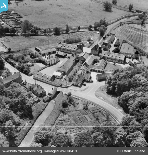
EAW030413 ENGLAND (1950). The Ship Inn and the Vynne and Everett Ltd Watermill, Narborough, 1950. This image was marked by Aerofilms Ltd for photo editing.
© Hawlfraint cyfranwyr OpenStreetMap a thrwyddedwyd gan yr OpenStreetMap Foundation. 2026. Trwyddedir y gartograffeg fel CC BY-SA.
Delweddau cyfagos (10)
EAW030413

EAW030414

EAW030415

EAW030417

EAW030421

EAW030418

EAW030416

EAW030420

EAW030419

EAW030422

Manylion
| Pennawd | [EAW030413] The Ship Inn and the Vynne and Everett Ltd Watermill, Narborough, 1950. This image was marked by Aerofilms Ltd for photo editing. |
| Cyfeirnod | EAW030413 |
| Dyddiad | 20-June-1950 |
| Dolen | |
| Enw lle | NARBOROUGH |
| Plwyf | NARBOROUGH |
| Ardal | |
| Gwlad | ENGLAND |
| Dwyreiniad / Gogleddiad | 574596, 313348 |
| Hydred / Lledred | 0.58359932532938, 52.689288368727 |
| Cyfeirnod Grid Cenedlaethol | TF746133 |
Pinnau

Matt Aldred edob.mattaldred.com |
Monday 20th of January 2025 09:44:48 AM | |

Sparky |
Monday 23rd of October 2017 10:22:58 PM |