
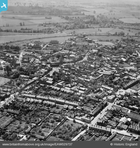
EAW029737 ENGLAND (1950). The town, Sudbury, from the north, 1950
© Hawlfraint cyfranwyr OpenStreetMap a thrwyddedwyd gan yr OpenStreetMap Foundation. 2026. Trwyddedir y gartograffeg fel CC BY-SA.
Delweddau cyfagos (4)
EAW029737

EAW042075

EAW042076

EAW042080

Manylion
| Pennawd | [EAW029737] The town, Sudbury, from the north, 1950 |
| Cyfeirnod | EAW029737 |
| Dyddiad | 30-May-1950 |
| Dolen | |
| Enw lle | SUDBURY |
| Plwyf | SUDBURY |
| Ardal | |
| Gwlad | ENGLAND |
| Dwyreiniad / Gogleddiad | 587463, 241583 |
| Hydred / Lledred | 0.7336652518677, 52.040481645021 |
| Cyfeirnod Grid Cenedlaethol | TL875416 |
Pinnau

Matt Aldred edob.mattaldred.com |
Tuesday 7th of January 2020 01:43:54 PM | |
|
Matt Aldred edob.mattaldred.com |
Tuesday 7th of January 2020 01:42:25 PM | |
|
Matt Aldred edob.mattaldred.com |
Tuesday 7th of January 2020 01:41:56 PM | |
|
Matt Aldred edob.mattaldred.com |
Tuesday 7th of January 2020 01:40:14 PM |