
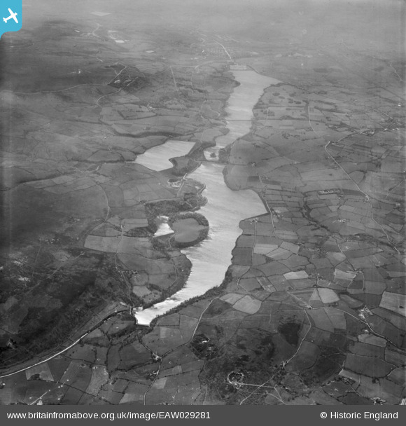
EAW029281 ENGLAND (1950). Anglezarke Reservoir, Yarrow Reservoir and Upper and Lower Rivington Reservoirs, Anglezarke Moor, 1950
© Hawlfraint cyfranwyr OpenStreetMap a thrwyddedwyd gan yr OpenStreetMap Foundation. 2026. Trwyddedir y gartograffeg fel CC BY-SA.
Delweddau cyfagos (2)
EAW029281

 0°
0m
0°
0m
EAW029280
 64°
159m
64°
159m
Manylion
| Pennawd | [EAW029281] Anglezarke Reservoir, Yarrow Reservoir and Upper and Lower Rivington Reservoirs, Anglezarke Moor, 1950 |
| Cyfeirnod | EAW029281 |
| Dyddiad | 11-May-1950 |
| Dolen | |
| Enw lle | ANGLEZARKE MOOR |
| Plwyf | ANGLEZARKE |
| Ardal | |
| Gwlad | ENGLAND |
| Dwyreiniad / Gogleddiad | 361821, 416426 |
| Hydred / Lledred | -2.5775697826033, 53.64271802822 |
| Cyfeirnod Grid Cenedlaethol | SD618164 |
Pinnau
Byddwch y cyntaf i ychwanegu sylw at y ddelwedd hon!
Cyfraniadau Grŵp
This photo shows the reservoirs running from north (closest the camera) to south. All four reservoirs were built to provide water for Liverpool. The river running into the reservoir at bottom left is known as The Goit and connects the hamlet of White Coppice (still a peaceful place) with Brinscall and eventually Roddlesworth reservoirs. Just visible on the left hand side of the far reservoir at junction of the triangular pathways is the mock castle folly built by the late Lord Leverhulme who at one time built a bungalow on the hills to the east, complete with extensive gardens, just below Rivington Pike. The bungalow was destroyed by fire, allegedly started by suffragetts and although never rebuilt parts of the orginal tiled floors can still be seem=n. |

Andrew |
Monday 16th of February 2015 09:40:58 PM |