
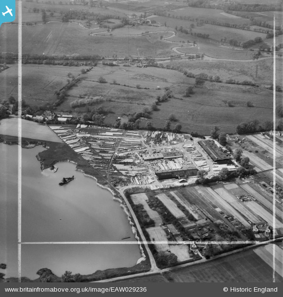
EAW029236 ENGLAND (1950). The Norcon Ltd Concrete Pipe Works, Ripley, 1950. This image was marked by Aerofilms Ltd for photo editing.
© Hawlfraint cyfranwyr OpenStreetMap a thrwyddedwyd gan yr OpenStreetMap Foundation. 2026. Trwyddedir y gartograffeg fel CC BY-SA.
Delweddau cyfagos (8)
EAW029236

 0°
0m
0°
0m
EAW029232
 166°
4m
166°
4m
EAW029235
 29°
10m
29°
10m
EAW029234
 28°
14m
28°
14m
EAW029238
 224°
29m
224°
29m
EAW029233
 2°
51m
2°
51m
EAW029237
 106°
62m
106°
62m
EAW029239
 140°
68m
140°
68m
Manylion
| Pennawd | [EAW029236] The Norcon Ltd Concrete Pipe Works, Ripley, 1950. This image was marked by Aerofilms Ltd for photo editing. |
| Cyfeirnod | EAW029236 |
| Dyddiad | 9-May-1950 |
| Dolen | |
| Enw lle | RIPLEY |
| Plwyf | RIPLEY |
| Ardal | |
| Gwlad | ENGLAND |
| Dwyreiniad / Gogleddiad | 503763, 156569 |
| Hydred / Lledred | -0.5115123239449, 51.29827228072 |
| Cyfeirnod Grid Cenedlaethol | TQ038566 |
Pinnau
 WW2 Pillbox Norcon WW2 Pillbox Norcon |

Sparky |
Monday 23rd of October 2017 12:13:45 AM |
| River Wey Navigation - opened 1653 runing for 15 miles from Guildford to the River Thames at Weybridge |

jsgskydive |
Tuesday 25th of February 2014 04:43:08 PM |
| Broadmead Cut - River Wey Improvement Scheme - part of a flood defence scheme constructed by Surrey County Council for Thames Conservancy (now Environment Agency) early 1930's from Godalming to Weybridge |
jsgskydive |
Tuesday 25th of February 2014 04:41:55 PM |
| River Wey |
jsgskydive |
Tuesday 25th of February 2014 04:39:32 PM |
| Papercourt Farm |
jsgskydive |
Tuesday 25th of February 2014 04:38:58 PM |
| Papercourt Lock Cottage, River Wey Navigation |
jsgskydive |
Tuesday 25th of February 2014 04:38:28 PM |
| Papercourt Lock, River Wey Navigation |
jsgskydive |
Tuesday 25th of February 2014 04:37:49 PM |