
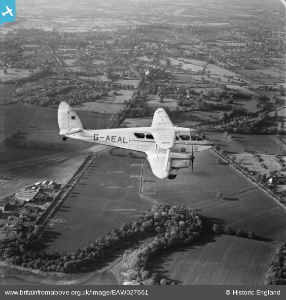
EAW027661 ENGLAND (1949). A Hunting Aerosurveys DH.89A Rapide (G-AEAL) in flight over the Elstree Road and North Western Avenue junction, Bushey Heath, 1949
© Hawlfraint cyfranwyr OpenStreetMap a thrwyddedwyd gan yr OpenStreetMap Foundation. 2026. Trwyddedir y gartograffeg fel CC BY-SA.
Delweddau cyfagos (13)
EAW027661
 in flight over the Elstree Road and North Western Avenue junction, Bushey Heath, 1949")
EPW053051

EPW053054

EPW053033

EPW053052

EPW053040

EPW053044

EAW027662
 in flight over Elstree Road and Aldenham Reservoir, Bushey Heath, 1949")
EAW041241

EAW023646

EPW053035

EPW053043

EAW023648

Manylion
| Pennawd | [EAW027661] A Hunting Aerosurveys DH.89A Rapide (G-AEAL) in flight over the Elstree Road and North Western Avenue junction, Bushey Heath, 1949 |
| Cyfeirnod | EAW027661 |
| Dyddiad | 14-November-1949 |
| Dolen | |
| Enw lle | BUSHEY HEATH |
| Plwyf | |
| Ardal | |
| Gwlad | ENGLAND |
| Dwyreiniad / Gogleddiad | 516304, 195218 |
| Hydred / Lledred | -0.3189661095853, 51.64325261286 |
| Cyfeirnod Grid Cenedlaethol | TQ163952 |
Pinnau

Graham |
Monday 18th of May 2020 05:23:06 PM | |

mapgeek |
Monday 28th of April 2014 04:49:26 PM | |
|
mapgeek |
Monday 28th of April 2014 04:48:28 PM | |
|
Ian K |
Thursday 20th of February 2014 02:11:36 PM |