
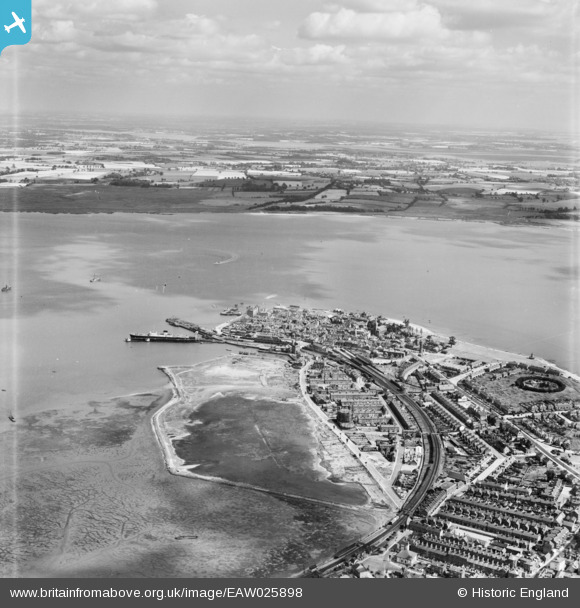
EAW025898 ENGLAND (1949). The town, Harwich, from the south-west, 1949
© Hawlfraint cyfranwyr OpenStreetMap a thrwyddedwyd gan yr OpenStreetMap Foundation. 2026. Trwyddedir y gartograffeg fel CC BY-SA.
Delweddau cyfagos (3)
EAW025898

EAW048288

EAW048285

Manylion
| Pennawd | [EAW025898] The town, Harwich, from the south-west, 1949 |
| Cyfeirnod | EAW025898 |
| Dyddiad | 10-August-1949 |
| Dolen | |
| Enw lle | HARWICH |
| Plwyf | HARWICH |
| Ardal | |
| Gwlad | ENGLAND |
| Dwyreiniad / Gogleddiad | 625710, 232255 |
| Hydred / Lledred | 1.2843515628522, 51.942497864202 |
| Cyfeirnod Grid Cenedlaethol | TM257323 |
Pinnau

redmist |
Sunday 18th of December 2022 09:09:53 PM | |
|
redmist |
Sunday 18th of December 2022 09:08:14 PM | |
|
redmist |
Sunday 18th of December 2022 09:07:08 PM | |
|
redmist |
Sunday 18th of December 2022 09:04:04 PM | |
|
redmist |
Sunday 18th of December 2022 09:02:18 PM | |

Matt Aldred edob.mattaldred.com |
Tuesday 1st of December 2020 08:43:22 PM | |
|
Matt Aldred edob.mattaldred.com |
Tuesday 1st of December 2020 08:41:05 PM | |
|
mannidaze |
Sunday 14th of September 2014 09:52:24 PM | |
|
cptpies |
Tuesday 14th of January 2014 08:55:47 AM | |
|
cptpies |
Tuesday 14th of January 2014 08:55:01 AM | |
|
cptpies |
Tuesday 14th of January 2014 08:54:11 AM | |
|
Al |
Monday 13th of January 2014 01:46:58 PM |
