
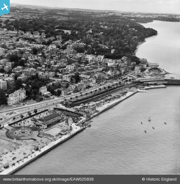
EAW025838 ENGLAND (1949). The seafront and town, Ryde, from the north-east, 1949. This image has been produced from a print.
© Hawlfraint cyfranwyr OpenStreetMap a thrwyddedwyd gan yr OpenStreetMap Foundation. 2026. Trwyddedir y gartograffeg fel CC BY-SA.
Delweddau cyfagos (6)
EAW025838

EPW000791

EPW023008

EPW023006

EPW016901

EAW022222

Manylion
| Pennawd | [EAW025838] The seafront and town, Ryde, from the north-east, 1949. This image has been produced from a print. |
| Cyfeirnod | EAW025838 |
| Dyddiad | 10-August-1949 |
| Dolen | |
| Enw lle | RYDE |
| Plwyf | RYDE |
| Ardal | |
| Gwlad | ENGLAND |
| Dwyreiniad / Gogleddiad | 459631, 92891 |
| Hydred / Lledred | -1.1549588043162, 50.731998683663 |
| Cyfeirnod Grid Cenedlaethol | SZ596929 |
Pinnau

Brightonboy |
Sunday 8th of January 2017 10:58:13 PM | |
|
John W |
Sunday 8th of January 2017 08:33:52 PM | |
|
John W |
Sunday 8th of January 2017 08:32:40 PM |