
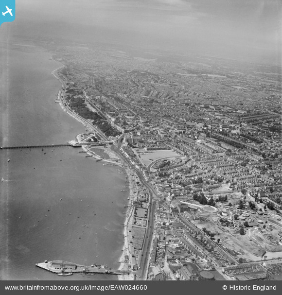
EAW024660 ENGLAND (1949). The waterfront and town from Corporation Landing Pier to The Shrubbery and beyond, Southend-on-Sea, from the east, 1949
© Hawlfraint cyfranwyr OpenStreetMap a thrwyddedwyd gan yr OpenStreetMap Foundation. 2026. Trwyddedir y gartograffeg fel CC BY-SA.
Delweddau cyfagos (48)
EAW024660

EAW053086

EPW000444

EPW058226

EPW036995

EPW037003

EPW036730

EPW024887

EPW062745

EPW036726

EPW058224

EAW002219

EPW000443

EPW058222

EPW037004

EPW040987

EPW036612

EAW002192

EPW032920

EPW036613

EPW039865

EAW024659

EPW036615

EPW062743

EPW036982

EPW024890

EPW032919

EPW036616

EPW037016

EPW062744

EPW040961

EPW062746

EPW024869

EPW036978

EPW039864

EPW039862

EPW062747

EPW036977

EPW036617

EPW036981

EPW036980

EPW058223

EPW058443

EPW036976

EPW036979

EPW032923

EPW039866

EPW010871

Manylion
| Pennawd | [EAW024660] The waterfront and town from Corporation Landing Pier to The Shrubbery and beyond, Southend-on-Sea, from the east, 1949 |
| Cyfeirnod | EAW024660 |
| Dyddiad | 11-July-1949 |
| Dolen | |
| Enw lle | SOUTHEND-ON-SEA |
| Plwyf | |
| Ardal | |
| Gwlad | ENGLAND |
| Dwyreiniad / Gogleddiad | 589106, 184968 |
| Hydred / Lledred | 0.7267389801565, 51.531421193678 |
| Cyfeirnod Grid Cenedlaethol | TQ891850 |
