
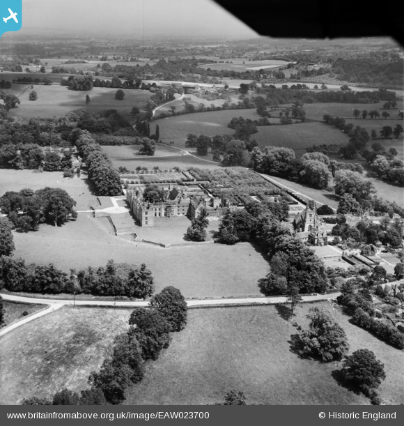
EAW023700 ENGLAND (1949). Penshurst Place and St John the Baptist's Church, Penshurst, from the south-west, 1949
© Hawlfraint cyfranwyr OpenStreetMap a thrwyddedwyd gan yr OpenStreetMap Foundation. 2026. Trwyddedir y gartograffeg fel CC BY-SA.
Delweddau cyfagos (4)
EAW023700

EAW023698

EAW023701

EAW023699

Manylion
| Pennawd | [EAW023700] Penshurst Place and St John the Baptist's Church, Penshurst, from the south-west, 1949 |
| Cyfeirnod | EAW023700 |
| Dyddiad | 12-June-1949 |
| Dolen | |
| Enw lle | PENSHURST |
| Plwyf | PENSHURST |
| Ardal | |
| Gwlad | ENGLAND |
| Dwyreiniad / Gogleddiad | 552552, 143891 |
| Hydred / Lledred | 0.18251068096071, 51.173360293331 |
| Cyfeirnod Grid Cenedlaethol | TQ526439 |
Pinnau

Matt Aldred edob.mattaldred.com |
Friday 1st of January 2021 10:21:24 PM | |

jrussill |
Thursday 11th of December 2014 06:46:52 PM | |

Alan McFaden |
Saturday 28th of December 2013 07:32:07 PM | |
|
Alan McFaden |
Saturday 28th of December 2013 07:31:18 PM |


Cyfraniadau Grŵp

WW2 anti tank pimples & roadblock |
jrussill |
Thursday 11th of December 2014 06:47:25 PM |