
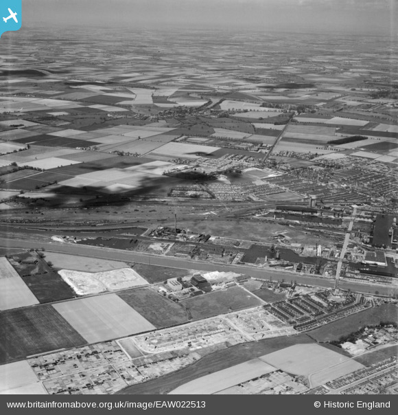
EAW022513 ENGLAND (1949). Goole Harbour, Goole, from the south-east, 1949
© Hawlfraint cyfranwyr OpenStreetMap a thrwyddedwyd gan yr OpenStreetMap Foundation. 2025. Trwyddedir y gartograffeg fel CC BY-SA.
Delweddau cyfagos (13)
EAW022513

EAW046084

EAW046080

EAW046086

EAW046087

EAW046085

EAW046083

EPW031411

EAW046082

EAW046081

EPW031420

EPW031412

EPW031421

Manylion
| Pennawd | [EAW022513] Goole Harbour, Goole, from the south-east, 1949 |
| Cyfeirnod | EAW022513 |
| Dyddiad | 20-April-1949 |
| Dolen | |
| Enw lle | GOOLE |
| Plwyf | GOOLE |
| Ardal | |
| Gwlad | ENGLAND |
| Dwyreiniad / Gogleddiad | 474130, 422610 |
| Hydred / Lledred | -0.8771755978013, 53.694438228299 |
| Cyfeirnod Grid Cenedlaethol | SE741226 |
Pinnau
 redmist |
Wednesday 16th of September 2020 09:33:13 AM | |
redmist |
Wednesday 16th of September 2020 09:32:41 AM | |
redmist |
Tuesday 12th of May 2020 02:12:45 PM | |
redmist |
Tuesday 12th of May 2020 02:12:04 PM | |
redmist |
Tuesday 12th of May 2020 02:11:23 PM | |
redmist |
Tuesday 12th of May 2020 02:10:50 PM | |
redmist |
Tuesday 12th of May 2020 02:10:12 PM | |
Soot1e |
Friday 2nd of January 2015 11:35:14 PM | |
Soot1e |
Friday 2nd of January 2015 11:17:19 PM | |
Soot1e |
Friday 2nd of January 2015 11:10:14 PM |