
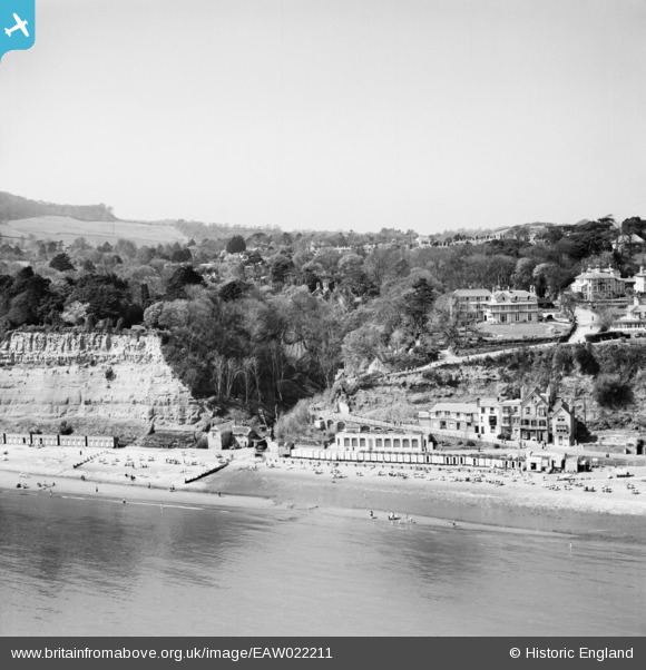
EAW022211 ENGLAND (1949). The mouth of the Shanklin Chine and the seafront, Shanklin, from the east, 1949
© Hawlfraint cyfranwyr OpenStreetMap a thrwyddedwyd gan yr OpenStreetMap Foundation. 2026. Trwyddedir y gartograffeg fel CC BY-SA.
Delweddau cyfagos (23)
EAW022211

EPW039647

EAW015237

EAW015236

EAW015238

EPW022918

EAW015234

EPW024583

EAW015235

EAW015240

EAW015239

EPW024582

EPW022920

EPW022914

EPW039646

EAW038586

EAW022214

EPW043003

EAW022213

EAW028276

EPW024580

EAW038585

EAW015241

Manylion
| Pennawd | [EAW022211] The mouth of the Shanklin Chine and the seafront, Shanklin, from the east, 1949 |
| Cyfeirnod | EAW022211 |
| Dyddiad | 17-May-1949 |
| Dolen | |
| Enw lle | SHANKLIN |
| Plwyf | SHANKLIN |
| Ardal | |
| Gwlad | ENGLAND |
| Dwyreiniad / Gogleddiad | 458554, 81080 |
| Hydred / Lledred | -1.1720903593697, 50.625893961601 |
| Cyfeirnod Grid Cenedlaethol | SZ586811 |
Pinnau

Kentishman |
Wednesday 12th of August 2015 08:22:45 PM | |
|
Adam |
Sunday 26th of July 2015 06:50:14 PM | |
|
Adam |
Sunday 26th of July 2015 06:49:39 PM | |
|
Al |
Tuesday 11th of March 2014 12:34:16 AM |
Cyfraniadau Grŵp

PLUTO, the Pipeline Under The Ocean, was laid from Shanklin Chine to Cherbourg on the 12th August 1944 and provided a constant supply of petrol to the allied forces during the liberation of France. |
Kentishman |
Wednesday 12th of August 2015 08:26:04 PM |
|
variant PB |
Al |
Tuesday 11th of March 2014 12:34:46 AM |