
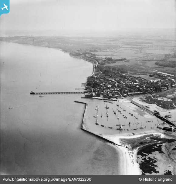
EAW022200 ENGLAND (1949). The Harbour, the Pier and the town, Yarmouth, from the west, 1949
© Hawlfraint cyfranwyr OpenStreetMap a thrwyddedwyd gan yr OpenStreetMap Foundation. 2026. Trwyddedir y gartograffeg fel CC BY-SA.
Delweddau cyfagos (4)
EAW022200

EAW022197

EPW022972

EPW022975

Manylion
| Pennawd | [EAW022200] The Harbour, the Pier and the town, Yarmouth, from the west, 1949 |
| Cyfeirnod | EAW022200 |
| Dyddiad | 17-April-1949 |
| Dolen | |
| Enw lle | YARMOUTH |
| Plwyf | FRESHWATER |
| Ardal | |
| Gwlad | ENGLAND |
| Dwyreiniad / Gogleddiad | 435038, 89788 |
| Hydred / Lledred | -1.5037464065884, 50.706097020143 |
| Cyfeirnod Grid Cenedlaethol | SZ350898 |
Pinnau
Byddwch y cyntaf i ychwanegu sylw at y ddelwedd hon!