
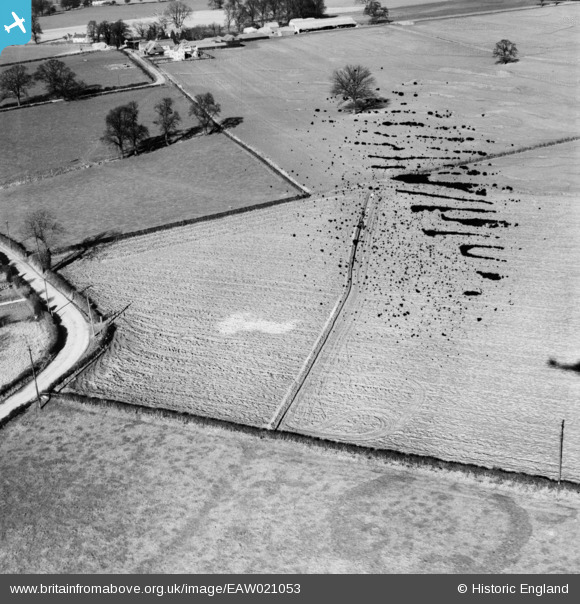
EAW021053 ENGLAND (1949). Drain laying in fields to the north of the village, Terling, 1949. This image has been produced from a damaged negative.
© Hawlfraint cyfranwyr OpenStreetMap a thrwyddedwyd gan yr OpenStreetMap Foundation. 2026. Trwyddedir y gartograffeg fel CC BY-SA.
Delweddau cyfagos (3)
EAW021053

 0°
0m
0°
0m
EAW021055
 359°
62m
359°
62m
EAW021054
 113°
149m
113°
149m
Manylion
| Pennawd | [EAW021053] Drain laying in fields to the north of the village, Terling, 1949. This image has been produced from a damaged negative. |
| Cyfeirnod | EAW021053 |
| Dyddiad | 16-February-1949 |
| Dolen | |
| Enw lle | TERLING |
| Plwyf | TERLING |
| Ardal | |
| Gwlad | ENGLAND |
| Dwyreiniad / Gogleddiad | 577511, 215356 |
| Hydred / Lledred | 0.57517863882157, 51.808167826878 |
| Cyfeirnod Grid Cenedlaethol | TL775154 |
Pinnau
 Ring Ditch Ring Ditch |

Sparky |
Saturday 26th of August 2017 02:24:51 PM |