
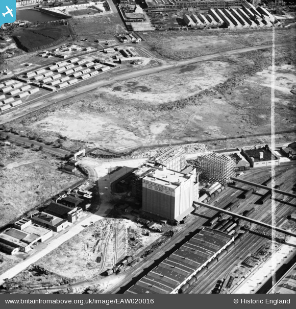
EAW020016 ENGLAND (1948). Construction work at J. Rank Ltd Solent Flour Mills, Southampton, 1948. This image was marked by Aerofilms Ltd for photo editing.
© Hawlfraint cyfranwyr OpenStreetMap a thrwyddedwyd gan yr OpenStreetMap Foundation. 2026. Trwyddedir y gartograffeg fel CC BY-SA.
Delweddau cyfagos (32)
EAW020016

EAW020020

EAW004219

EAW035624

EAW035616

EAW004212

EAW004214

EAW020014

EAW004213

EAW004216

EAW004218

EAW004220

EAW020012

EAW004221

EAW035625

EAW004215

EAW020018

EAW035622

EAW020021

EPW032349
 under construction, Southampton, from the west, 1930. This image has been produced from a copy-negative.")
EAW035620

EAW004217

EAW020019

EAW035619

EAW035623

EAW035615

EAW035621

EAW035618

EAW035617

EAW020013

EAW020015

EAW001344
, Southampton, from the south, 1946")
Manylion
| Pennawd | [EAW020016] Construction work at J. Rank Ltd Solent Flour Mills, Southampton, 1948. This image was marked by Aerofilms Ltd for photo editing. |
| Cyfeirnod | EAW020016 |
| Dyddiad | 19-October-1948 |
| Dolen | |
| Enw lle | SOUTHAMPTON |
| Plwyf | |
| Ardal | |
| Gwlad | ENGLAND |
| Dwyreiniad / Gogleddiad | 441109, 111731 |
| Hydred / Lledred | -1.4153075963366, 50.903035186281 |
| Cyfeirnod Grid Cenedlaethol | SU411117 |
Pinnau
Byddwch y cyntaf i ychwanegu sylw at y ddelwedd hon!
Cyfraniadau Grŵp
Rank's Solent Flour Mills, Western Docks, Southampton, were completed in 1934, the first building on the Docks Extension Industrial Estate. The flour mills and warehouse were heavily damaged by an air raid on 30 November 1941 and put out of action. Mills in Bath and Warmley, near Bristol, were brought into production to compensate for the loss of production here and at Joseph Rank's mills in London. After World War II the Solent Flour Mills were rebuilt - and it seems, from comparing the 1948 and 1951 shots - extended. |

MB |
Friday 16th of September 2016 06:46:38 PM |