
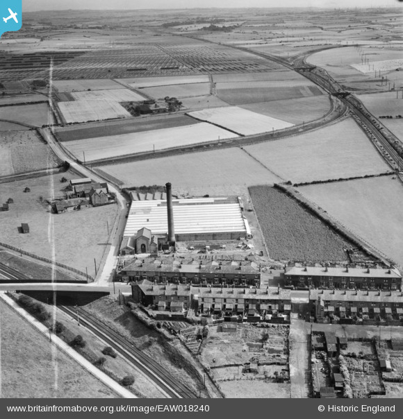
EAW018240 ENGLAND (1948). Blackrod Mill and houses on Station Road, Blackrod, from the north-west, 1948. This image was marked by Aerofilms Ltd for photo editing.
© Hawlfraint cyfranwyr OpenStreetMap a thrwyddedwyd gan yr OpenStreetMap Foundation. 2026. Trwyddedir y gartograffeg fel CC BY-SA.
Delweddau cyfagos (8)
EAW018240

EAW018235

EAW018234

EAW018236

EAW018233

EAW018237

EAW018239

EAW018238

Manylion
| Pennawd | [EAW018240] Blackrod Mill and houses on Station Road, Blackrod, from the north-west, 1948. This image was marked by Aerofilms Ltd for photo editing. |
| Cyfeirnod | EAW018240 |
| Dyddiad | 18-August-1948 |
| Dolen | |
| Enw lle | BLACKROD |
| Plwyf | BLACKROD |
| Ardal | |
| Gwlad | ENGLAND |
| Dwyreiniad / Gogleddiad | 362576, 410644 |
| Hydred / Lledred | -2.5654538497466, 53.590799066464 |
| Cyfeirnod Grid Cenedlaethol | SD626106 |
Pinnau

FrankH |
Wednesday 28th of October 2020 10:19:47 PM | |
|
FrankH |
Wednesday 28th of October 2020 10:18:19 PM | |
|
FrankH |
Wednesday 28th of October 2020 10:17:16 PM |
Cyfraniadau Grŵp
horwich fork juntion |
michael snape |
Thursday 17th of July 2014 10:13:31 PM |