
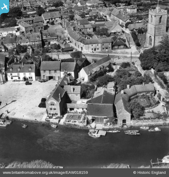
EAW018159 ENGLAND (1948). The Old Granary at The Quay, Wareham, 1948. This image has been produced from a print.
© Hawlfraint cyfranwyr OpenStreetMap a thrwyddedwyd gan yr OpenStreetMap Foundation. 2026. Trwyddedir y gartograffeg fel CC BY-SA.
Delweddau cyfagos (13)
EAW018159

EPW013661

EAW018142

EPW013663

EPW032294

EAW018141

EPW061383

EPW061381

EPW061380

EPW061385

EPW061379

EPW061382

EAW018140

Manylion
| Pennawd | [EAW018159] The Old Granary at The Quay, Wareham, 1948. This image has been produced from a print. |
| Cyfeirnod | EAW018159 |
| Dyddiad | 16-August-1948 |
| Dolen | |
| Enw lle | WAREHAM |
| Plwyf | WAREHAM TOWN |
| Ardal | |
| Gwlad | ENGLAND |
| Dwyreiniad / Gogleddiad | 392418, 87168 |
| Hydred / Lledred | -2.107334372771, 50.683540133867 |
| Cyfeirnod Grid Cenedlaethol | SY924872 |
Pinnau

Class31 |
Wednesday 8th of April 2015 05:03:16 PM |

Cyfraniadau Grŵp

Lady St. Mary Church, Wareham, 06/04/2015 |
Class31 |
Wednesday 8th of April 2015 05:06:29 PM |

The Quay, Wareham, 06/04/2015 |
Class31 |
Wednesday 8th of April 2015 05:05:38 PM |

The Quay, Wareham, 06/04/2015 |
Class31 |
Wednesday 8th of April 2015 05:04:58 PM |

The Quay, Wareham, 06/04/2015 |
Class31 |
Wednesday 8th of April 2015 05:03:57 PM |