
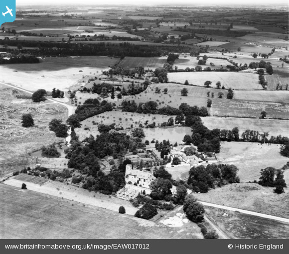
EAW017012 ENGLAND (1948). The Church of St Mary the Virgin, Manor House and the surrounding countryside, Little Easton, from the south-east, 1948. This image has been produced from a damaged print.
© Hawlfraint cyfranwyr OpenStreetMap a thrwyddedwyd gan yr OpenStreetMap Foundation. 2026. Trwyddedir y gartograffeg fel CC BY-SA.
Delweddau cyfagos (5)
EAW017012

EAW017015

EAW017011

EAW017014

EAW017013

Manylion
| Pennawd | [EAW017012] The Church of St Mary the Virgin, Manor House and the surrounding countryside, Little Easton, from the south-east, 1948. This image has been produced from a damaged print. |
| Cyfeirnod | EAW017012 |
| Dyddiad | 6-July-1948 |
| Dolen | |
| Enw lle | LITTLE EASTON |
| Plwyf | LITTLE EASTON |
| Ardal | |
| Gwlad | ENGLAND |
| Dwyreiniad / Gogleddiad | 560462, 223489 |
| Hydred / Lledred | 0.33185351426228, 51.886393244697 |
| Cyfeirnod Grid Cenedlaethol | TL605235 |
Pinnau
Byddwch y cyntaf i ychwanegu sylw at y ddelwedd hon!