
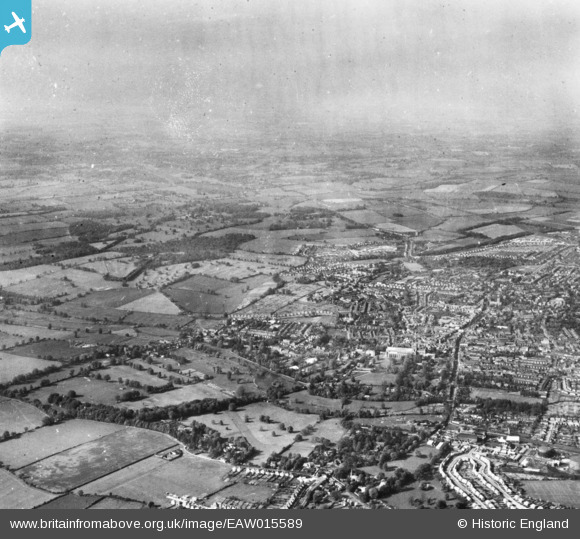
EAW015589 ENGLAND (1948). The site of Verulamium Roman Town and the city, St Albans, from the south, 1948. This image has been produced from a print.
© Hawlfraint cyfranwyr OpenStreetMap a thrwyddedwyd gan yr OpenStreetMap Foundation. 2026. Trwyddedir y gartograffeg fel CC BY-SA.
Delweddau cyfagos (8)
EAW015589

EAW003453

EAW030944

EAW030945

EAW025081

EAW025082

EAW025080

EAW025077

Manylion
| Pennawd | [EAW015589] The site of Verulamium Roman Town and the city, St Albans, from the south, 1948. This image has been produced from a print. |
| Cyfeirnod | EAW015589 |
| Dyddiad | 13-May-1948 |
| Dolen | |
| Enw lle | ST ALBANS |
| Plwyf | |
| Ardal | |
| Gwlad | ENGLAND |
| Dwyreiniad / Gogleddiad | 514112, 206892 |
| Hydred / Lledred | -0.34681463468335, 51.748633147866 |
| Cyfeirnod Grid Cenedlaethol | TL141069 |
Pinnau
Byddwch y cyntaf i ychwanegu sylw at y ddelwedd hon!