
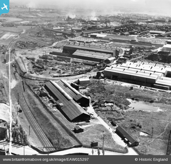
EAW015297 ENGLAND (1948). The Willenhall Foundry and the surrounding industrial area, Willenhall, from the north-west, 1948. This image has been produced from a print marked by Aerofilms Ltd for photo editing.
© Hawlfraint cyfranwyr OpenStreetMap a thrwyddedwyd gan yr OpenStreetMap Foundation. 2026. Trwyddedir y gartograffeg fel CC BY-SA.
Delweddau cyfagos (9)
EAW015297

 0°
0m
0°
0m
EAW015299
 98°
36m
98°
36m
EAW015293
 110°
40m
110°
40m
EAW015298
 63°
57m
63°
57m
EAW015295
 112°
64m
112°
64m
EAW015296
 101°
101m
101°
101m
EAW015294
 99°
113m
99°
113m
EAW015300
 94°
118m
94°
118m
EAW015301
 126°
232m
126°
232m
Manylion
| Pennawd | [EAW015297] The Willenhall Foundry and the surrounding industrial area, Willenhall, from the north-west, 1948. This image has been produced from a print marked by Aerofilms Ltd for photo editing. |
| Cyfeirnod | EAW015297 |
| Dyddiad | 7-May-1948 |
| Dolen | |
| Enw lle | WILLENHALL |
| Plwyf | |
| Ardal | |
| Gwlad | ENGLAND |
| Dwyreiniad / Gogleddiad | 397091, 298218 |
| Hydred / Lledred | -2.0429365749346, 52.581407825384 |
| Cyfeirnod Grid Cenedlaethol | SO971982 |
Pinnau
 Possibly a 2ndWW firewatchers post? Possibly a 2ndWW firewatchers post? |

redmist |
Wednesday 12th of October 2022 02:39:28 PM |