
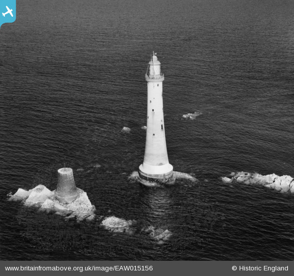
EAW015156 ENGLAND (1948). Eddystone Lighthouse and the foundations of Smeaton's Tower, Plymouth, 1948
© Hawlfraint cyfranwyr OpenStreetMap a thrwyddedwyd gan yr OpenStreetMap Foundation. 2026. Trwyddedir y gartograffeg fel CC BY-SA.
Delweddau cyfagos (3)
EAW015156

EAW015155

EAW015154

Manylion
| Pennawd | [EAW015156] Eddystone Lighthouse and the foundations of Smeaton's Tower, Plymouth, 1948 |
| Cyfeirnod | EAW015156 |
| Dyddiad | 29-April-1948 |
| Dolen | |
| Enw lle | PLYMOUTH |
| Plwyf | MAKER-WITH-RAME |
| Ardal | |
| Gwlad | ENGLAND |
| Dwyreiniad / Gogleddiad | 238181, 33988 |
| Hydred / Lledred | -4.2668722024795, 50.183160623745 |
| Cyfeirnod Grid Cenedlaethol | SX382340 |
Pinnau
Byddwch y cyntaf i ychwanegu sylw at y ddelwedd hon!