
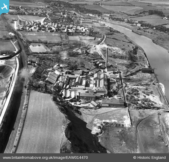
EAW014470 ENGLAND (1948). The Ford Paper Mill, South Hylton, 1948
© Hawlfraint cyfranwyr OpenStreetMap a thrwyddedwyd gan yr OpenStreetMap Foundation. 2026. Trwyddedir y gartograffeg fel CC BY-SA.
Delweddau cyfagos (15)
EAW014470

EAW014476

EAW014474

EAW014472

EAW014471

EAW014479

EAW014469

EAW014478

EAW014475

EAW014477

EPW016428

EAW014473

EPW016427

EPW016434

EPW016432

Manylion
| Pennawd | [EAW014470] The Ford Paper Mill, South Hylton, 1948 |
| Cyfeirnod | EAW014470 |
| Dyddiad | 15-April-1948 |
| Dolen | |
| Enw lle | SOUTH HYLTON |
| Plwyf | |
| Ardal | |
| Gwlad | ENGLAND |
| Dwyreiniad / Gogleddiad | 435977, 557380 |
| Hydred / Lledred | -1.4387843868661, 54.909751560092 |
| Cyfeirnod Grid Cenedlaethol | NZ360574 |
Pinnau

PinzaC55 |
Monday 19th of June 2023 03:18:10 PM | |
|
Jane |
Friday 10th of April 2015 09:20:50 AM | |

Dylan Moore |
Tuesday 24th of December 2013 06:18:32 PM | |
|
kevin n |
Tuesday 24th of December 2013 04:41:03 PM | |
|
kevin n |
Tuesday 24th of December 2013 04:39:24 PM | |
|
kevin n |
Tuesday 24th of December 2013 04:34:00 PM | |
|
kevin n |
Tuesday 24th of December 2013 04:31:37 PM | |
|
kevin n |
Tuesday 24th of December 2013 04:29:36 PM |