
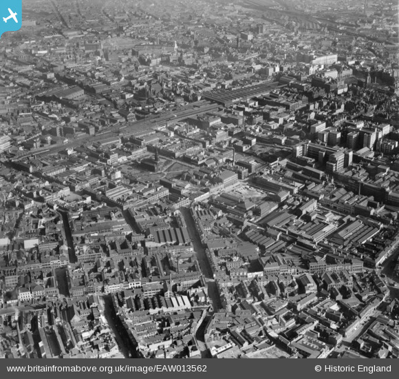
EAW013562 ENGLAND (1948). The city centre including Graham Street, St Paul's Square and Snow Hill Station, Birmingham, 1948
© Hawlfraint cyfranwyr OpenStreetMap a thrwyddedwyd gan yr OpenStreetMap Foundation. 2026. Trwyddedir y gartograffeg fel CC BY-SA.
Delweddau cyfagos (2)
EAW013562

EPW053101

Manylion
| Pennawd | [EAW013562] The city centre including Graham Street, St Paul's Square and Snow Hill Station, Birmingham, 1948 |
| Cyfeirnod | EAW013562 |
| Dyddiad | 9-March-1948 |
| Dolen | |
| Enw lle | BIRMINGHAM |
| Plwyf | |
| Ardal | |
| Gwlad | ENGLAND |
| Dwyreiniad / Gogleddiad | 406431, 287394 |
| Hydred / Lledred | -1.905288689905, 52.484059905282 |
| Cyfeirnod Grid Cenedlaethol | SP064874 |
Pinnau

areed |
Saturday 4th of July 2020 07:56:51 PM | |
|
Glassman |
Monday 1st of December 2014 09:42:37 AM | |
|
Glassman |
Monday 1st of December 2014 09:29:34 AM | |
|
Glassman |
Monday 1st of December 2014 09:28:26 AM | |
|
Glassman |
Monday 1st of December 2014 09:26:33 AM | |

Class31 |
Tuesday 18th of November 2014 01:56:37 PM | |
|
Class31 |
Tuesday 18th of November 2014 01:54:42 PM | |
|
Class31 |
Tuesday 18th of November 2014 01:51:27 PM | |
|
Class31 |
Tuesday 18th of November 2014 01:50:45 PM | |
|
Class31 |
Tuesday 18th of November 2014 01:49:46 PM | |
|
Martin |
Monday 30th of December 2013 09:46:23 PM | |
|
Glassman |
Monday 25th of November 2013 04:02:47 PM |


