
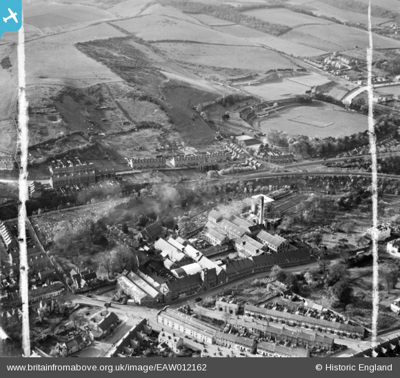
EAW012162 ENGLAND (1947). Buckland Paper Mill and environs, Buckland, 1947. This image was marked by Aerofilms Ltd for photo editing.
© Hawlfraint cyfranwyr OpenStreetMap a thrwyddedwyd gan yr OpenStreetMap Foundation. 2026. Trwyddedir y gartograffeg fel CC BY-SA.
Delweddau cyfagos (10)
EAW012162

EAW012161

EAW012163

EAW012160

EAW012164

EAW012159

EAW012158

EPW038165

EPW038166

EPW038164

Manylion
| Pennawd | [EAW012162] Buckland Paper Mill and environs, Buckland, 1947. This image was marked by Aerofilms Ltd for photo editing. |
| Cyfeirnod | EAW012162 |
| Dyddiad | 10-November-1947 |
| Dolen | |
| Enw lle | BUCKLAND |
| Plwyf | DOVER |
| Ardal | |
| Gwlad | ENGLAND |
| Dwyreiniad / Gogleddiad | 630344, 142742 |
| Hydred / Lledred | 1.2930815997852, 51.137012086731 |
| Cyfeirnod Grid Cenedlaethol | TR303427 |
