
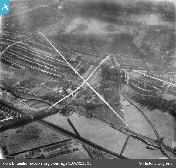
EAW012066 ENGLAND (1947). Harrison's Plantation and the surrounding residential area, Wollaton, 1947. This image was marked by Aerofilms Ltd for photo editing.
© Hawlfraint cyfranwyr OpenStreetMap a thrwyddedwyd gan yr OpenStreetMap Foundation. 2026. Trwyddedir y gartograffeg fel CC BY-SA.
Delweddau cyfagos (8)
EAW012066

EAW012077

EAW012075

EAW012073

EAW012074

EAW012076

EAW012058

EAW012065

Manylion
| Pennawd | [EAW012066] Harrison's Plantation and the surrounding residential area, Wollaton, 1947. This image was marked by Aerofilms Ltd for photo editing. |
| Cyfeirnod | EAW012066 |
| Dyddiad | 5-November-1947 |
| Dolen | |
| Enw lle | WOLLATON |
| Plwyf | |
| Ardal | |
| Gwlad | ENGLAND |
| Dwyreiniad / Gogleddiad | 453259, 340198 |
| Hydred / Lledred | -1.2071157900323, 52.956195145632 |
| Cyfeirnod Grid Cenedlaethol | SK533402 |
Pinnau
Byddwch y cyntaf i ychwanegu sylw at y ddelwedd hon!