
EAW011309 ENGLAND (1947). Elderstub Lane, Rougham Heath and environs, Blackthorpe, 1947

© Hawlfraint cyfranwyr OpenStreetMap a thrwyddedwyd gan yr OpenStreetMap Foundation. 2026. Trwyddedir y gartograffeg fel CC BY-SA.
Manylion
| Pennawd | [EAW011309] Elderstub Lane, Rougham Heath and environs, Blackthorpe, 1947 |
| Cyfeirnod | EAW011309 |
| Dyddiad | 1-October-1947 |
| Dolen | |
| Enw lle | BLACKTHORPE |
| Plwyf | RUSHBROOKE WITH ROUGHAM |
| Ardal | |
| Gwlad | ENGLAND |
| Dwyreiniad / Gogleddiad | 588866, 263066 |
| Hydred / Lledred | 0.7660328907552, 52.232946275419 |
| Cyfeirnod Grid Cenedlaethol | TL889631 |
Pinnau

Matt Aldred edob.mattaldred.com |
Sunday 1st of August 2021 09:04:20 PM | |
|
Matt Aldred edob.mattaldred.com |
Sunday 1st of August 2021 09:04:07 PM | |
|
Matt Aldred edob.mattaldred.com |
Sunday 1st of August 2021 09:02:28 PM | |
|
Matt Aldred edob.mattaldred.com |
Sunday 1st of August 2021 09:02:16 PM | |
|
Matt Aldred edob.mattaldred.com |
Sunday 1st of August 2021 09:02:00 PM | |
|
Matt Aldred edob.mattaldred.com |
Sunday 1st of August 2021 08:58:00 PM |
Cyfraniadau Grŵp
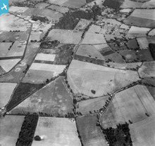
'Closed' runways (marked with 'X's) and hangar at Rougham, Suffolk. Top left-hand corner. |

Where's Canning Town? |
Wednesday 12th of February 2014 08:39:16 PM |