
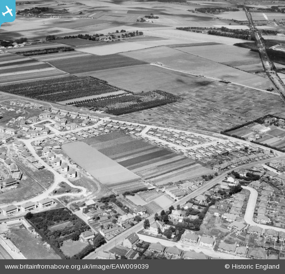
EAW009039 ENGLAND (1947). The residential area at Newington (surrounding Melbourne Avenue) under construction, Ramsgate, 1947
© Hawlfraint cyfranwyr OpenStreetMap a thrwyddedwyd gan yr OpenStreetMap Foundation. 2026. Trwyddedir y gartograffeg fel CC BY-SA.
Delweddau cyfagos (9)
EAW009039
 under construction, Ramsgate, 1947")
EAW009043
 under construction, Ramsgate, 1947")
EAW009038
 under construction, Ramsgate, 1947")
EAW009034
 under construction, Ramsgate, 1947")
EAW009042
 under construction, Ramsgate, 1947")
EAW009037
 under construction, Ramsgate, 1947")
EAW009033
 under construction, Ramsgate, 1947")
EAW009032
 under construction, Ramsgate, 1947")
EAW009036
 under construction, Ramsgate, 1947")
Manylion
| Pennawd | [EAW009039] The residential area at Newington (surrounding Melbourne Avenue) under construction, Ramsgate, 1947 |
| Cyfeirnod | EAW009039 |
| Dyddiad | 12-August-1947 |
| Dolen | |
| Enw lle | RAMSGATE |
| Plwyf | RAMSGATE |
| Ardal | |
| Gwlad | ENGLAND |
| Dwyreiniad / Gogleddiad | 636623, 166545 |
| Hydred / Lledred | 1.3984105566899, 51.348135158887 |
| Cyfeirnod Grid Cenedlaethol | TR366665 |
Pinnau

John W |
Friday 7th of October 2016 08:41:54 PM |