
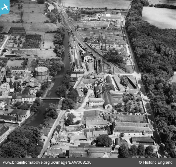
EAW008130 ENGLAND (1947). Brewery and malt house buildings between Barnack Road and Water Street and the railway terminus, Stamford, 1947
© Hawlfraint cyfranwyr OpenStreetMap a thrwyddedwyd gan yr OpenStreetMap Foundation. 2026. Trwyddedir y gartograffeg fel CC BY-SA.
Delweddau cyfagos (10)
EAW008130

EAW008126

EAW008127

EAW008125

EAW008131

EAW008128

EAW008132

EAW008129

EPW054984

EPW054983

Manylion
| Pennawd | [EAW008130] Brewery and malt house buildings between Barnack Road and Water Street and the railway terminus, Stamford, 1947 |
| Cyfeirnod | EAW008130 |
| Dyddiad | 12-July-1947 |
| Dolen | |
| Enw lle | STAMFORD |
| Plwyf | STAMFORD |
| Ardal | |
| Gwlad | ENGLAND |
| Dwyreiniad / Gogleddiad | 503409, 306891 |
| Hydred / Lledred | -0.47127398567696, 52.649532016986 |
| Cyfeirnod Grid Cenedlaethol | TF034069 |
