
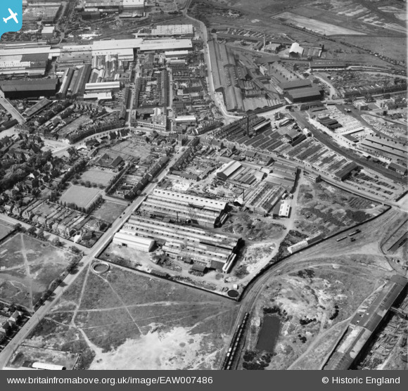
EAW007486 ENGLAND (1947). The Charles Richards and Sons Nut and Bolt Works and the surrounding industrial area, Darlaston Green, 1947
© Hawlfraint cyfranwyr OpenStreetMap a thrwyddedwyd gan yr OpenStreetMap Foundation. 2026. Trwyddedir y gartograffeg fel CC BY-SA.
Delweddau cyfagos (24)
EAW007486

EAW007485

EAW007488

EPW046099

EAW007487

EAW007489

EPW046091

EAW007484

EAW007490

EPW046093

EAW007492

EPW046098

EPW046097

EPW046092

EPW046095

EAW007494

EPW046096

EAW007493

EAW007491

EPW046087

EPW046094

EPW046088

EPW046089

EPW046090

Manylion
| Pennawd | [EAW007486] The Charles Richards and Sons Nut and Bolt Works and the surrounding industrial area, Darlaston Green, 1947 |
| Cyfeirnod | EAW007486 |
| Dyddiad | 3-June-1947 |
| Dolen | |
| Enw lle | DARLASTON GREEN |
| Plwyf | |
| Ardal | |
| Gwlad | ENGLAND |
| Dwyreiniad / Gogleddiad | 397988, 297511 |
| Hydred / Lledred | -2.0296926441606, 52.575055349498 |
| Cyfeirnod Grid Cenedlaethol | SO980975 |
Pinnau
Byddwch y cyntaf i ychwanegu sylw at y ddelwedd hon!