
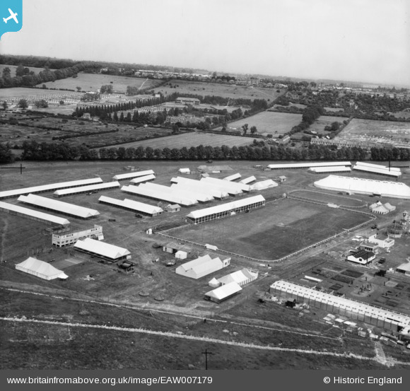
EAW007179 ENGLAND (1947). Lincoln, Setting up for the Royal Agricultural Show on West Common, from the south-west, 1947
© Hawlfraint cyfranwyr OpenStreetMap a thrwyddedwyd gan yr OpenStreetMap Foundation. 2026. Trwyddedir y gartograffeg fel CC BY-SA.
Delweddau cyfagos (9)
EAW007179

EAW007183

EAW007171

EAW007184

EAW007175

EAW007180

EAW007177

EAW007185

EAW007174

Manylion
| Pennawd | [EAW007179] Lincoln, Setting up for the Royal Agricultural Show on West Common, from the south-west, 1947 |
| Cyfeirnod | EAW007179 |
| Dyddiad | 25-June-1947 |
| Dolen | |
| Enw lle | LINCOLN |
| Plwyf | |
| Ardal | |
| Gwlad | ENGLAND |
| Dwyreiniad / Gogleddiad | 495840, 372364 |
| Hydred / Lledred | -0.56376926202984, 53.23936181742 |
| Cyfeirnod Grid Cenedlaethol | SK958724 |
Pinnau
Byddwch y cyntaf i ychwanegu sylw at y ddelwedd hon!