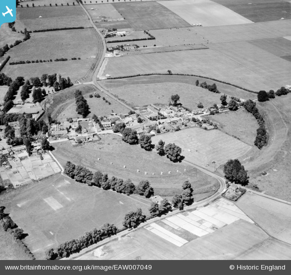
EAW007049 ENGLAND (1947). Avebury Henge and Stone Circles surrounding the village, Avebury, 1947
© Hawlfraint cyfranwyr OpenStreetMap a thrwyddedwyd gan yr OpenStreetMap Foundation. 2026. Trwyddedir y gartograffeg fel CC BY-SA.
Delweddau cyfagos (15)
EAW007049

EAW007055

EAW007046

EAW034897

EAW007056

EAW007057

EAW034898

EAW034899

EAW049153

EAW007048

EAW049151

EAW007058

EAW007047

EAW049152

EAW007054

Manylion
| Pennawd | [EAW007049] Avebury Henge and Stone Circles surrounding the village, Avebury, 1947 |
| Cyfeirnod | EAW007049 |
| Dyddiad | 11-June-1947 |
| Dolen | |
| Enw lle | AVEBURY |
| Plwyf | AVEBURY |
| Ardal | |
| Gwlad | ENGLAND |
| Dwyreiniad / Gogleddiad | 410222, 169927 |
| Hydred / Lledred | -1.8529541354461, 51.42776483199 |
| Cyfeirnod Grid Cenedlaethol | SU102699 |