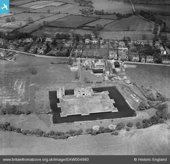
EAW004983 ENGLAND (1947). Kirby Muxloe Castle, Kirby Muxloe, 1947
© Hawlfraint cyfranwyr OpenStreetMap a thrwyddedwyd gan yr OpenStreetMap Foundation. 2025. Trwyddedir y gartograffeg fel CC BY-SA.
Delweddau cyfagos (7)
EAW004983

EAW004986

EAW004982

EPW055012

EAW004984

EAW004981

EAW004985

Manylion
| Pennawd | [EAW004983] Kirby Muxloe Castle, Kirby Muxloe, 1947 |
| Cyfeirnod | EAW004983 |
| Dyddiad | 7-May-1947 |
| Dolen | |
| Enw lle | KIRBY MUXLOE |
| Plwyf | KIRBY MUXLOE |
| Ardal | |
| Gwlad | ENGLAND |
| Dwyreiniad / Gogleddiad | 452332, 304648 |
| Hydred / Lledred | -1.2266047843274, 52.636702541887 |
| Cyfeirnod Grid Cenedlaethol | SK523046 |
Pinnau

totoro |
Tuesday 15th of October 2013 09:12:09 PM | |
|
totoro |
Tuesday 15th of October 2013 09:09:23 PM | |
|
totoro |
Tuesday 15th of October 2013 08:51:08 PM | |
|
totoro |
Tuesday 15th of October 2013 08:50:41 PM | |
|
totoro |
Tuesday 15th of October 2013 08:50:06 PM | |
|
totoro |
Tuesday 15th of October 2013 08:48:52 PM | |
|
totoro |
Tuesday 15th of October 2013 08:48:23 PM |