
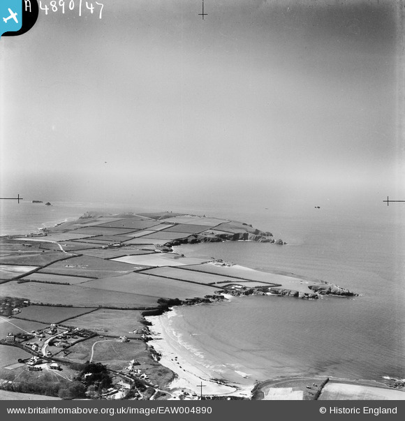
EAW004890 ENGLAND (1947). Polventon Bay and Harlyn Bay, Trevose Head, from the south-east, 1947
© Hawlfraint cyfranwyr OpenStreetMap a thrwyddedwyd gan yr OpenStreetMap Foundation. 2026. Trwyddedir y gartograffeg fel CC BY-SA.
Manylion
| Pennawd | [EAW004890] Polventon Bay and Harlyn Bay, Trevose Head, from the south-east, 1947 |
| Cyfeirnod | EAW004890 |
| Dyddiad | April-1947 |
| Dolen | |
| Enw lle | TREVOSE HEAD |
| Plwyf | ST. MERRYN |
| Ardal | |
| Gwlad | ENGLAND |
| Dwyreiniad / Gogleddiad | 187236, 75809 |
| Hydred / Lledred | -5.0032701302963, 50.542689891011 |
| Cyfeirnod Grid Cenedlaethol | SW872758 |
Pinnau

Matt Aldred edob.mattaldred.com |
Sunday 10th of March 2024 04:55:21 PM | |
|
Matt Aldred edob.mattaldred.com |
Sunday 10th of March 2024 04:54:46 PM | |

redmist |
Thursday 2nd of February 2023 07:26:34 PM | |
|
redmist |
Thursday 2nd of February 2023 07:13:09 PM | |
|
redmist |
Thursday 2nd of February 2023 07:10:11 PM | |
|
Peter Kirk |
Wednesday 25th of June 2014 10:12:49 PM | |
|
Peter Kirk |
Wednesday 25th of June 2014 10:11:12 PM | |
|
cptpies |
Thursday 16th of January 2014 01:33:28 PM |

