
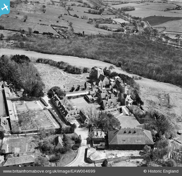
EAW004699 ENGLAND (1947). Lympne Castle, St Stephen's Church and the surrounding countryside, Lympne, 1947
© Hawlfraint cyfranwyr OpenStreetMap a thrwyddedwyd gan yr OpenStreetMap Foundation. 2026. Trwyddedir y gartograffeg fel CC BY-SA.
Delweddau cyfagos (7)
EAW004699

EAW004697

EAW004698

EAW004700

EAW004701

EAW004696

EAW004695

Manylion
| Pennawd | [EAW004699] Lympne Castle, St Stephen's Church and the surrounding countryside, Lympne, 1947 |
| Cyfeirnod | EAW004699 |
| Dyddiad | 26-April-1947 |
| Dolen | |
| Enw lle | LYMPNE |
| Plwyf | LYMPNE |
| Ardal | |
| Gwlad | ENGLAND |
| Dwyreiniad / Gogleddiad | 611964, 134666 |
| Hydred / Lledred | 1.0259813548687, 51.071584682865 |
| Cyfeirnod Grid Cenedlaethol | TR120347 |
Pinnau

cptpies |
Monday 8th of December 2014 08:51:59 AM | |
|
totoro |
Friday 25th of October 2013 11:04:06 PM | |
|
totoro |
Friday 25th of October 2013 11:03:27 PM | |
|
totoro |
Friday 25th of October 2013 11:03:11 PM |
Cyfraniadau Grŵp

Pillbox, top left corner of the image. |
cptpies |
Monday 8th of December 2014 08:53:40 AM |