
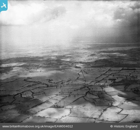
EAW004012 ENGLAND (1947). Flooding at Longdon Marsh and Marsh End, Longdon, from the south-west, 1947
© Hawlfraint cyfranwyr OpenStreetMap a thrwyddedwyd gan yr OpenStreetMap Foundation. 2026. Trwyddedir y gartograffeg fel CC BY-SA.
Delweddau cyfagos (2)
EAW004012

EAW004013

Manylion
| Pennawd | [EAW004012] Flooding at Longdon Marsh and Marsh End, Longdon, from the south-west, 1947 |
| Cyfeirnod | EAW004012 |
| Dyddiad | 21-March-1947 |
| Dolen | |
| Enw lle | LONGDON |
| Plwyf | LONGDON |
| Ardal | |
| Gwlad | ENGLAND |
| Dwyreiniad / Gogleddiad | 381739, 235597 |
| Hydred / Lledred | -2.2661323211273, 52.018071938088 |
| Cyfeirnod Grid Cenedlaethol | SO817356 |
Pinnau
Cyfraniadau Grŵp
View from above Birtsmorton looking slightly north of east. |

Class31 |
Tuesday 3rd of September 2013 12:59:19 PM |
Thanks for the location Class31; we'll update the catalogue and post your new data here in due course. Yours, Katy Britain from Above Cataloguing Team Leader |
Katy Whitaker |
Tuesday 3rd of September 2013 12:59:19 PM |
Eureka It looks like I could be here for a long time with lots in this series! |
Class31 |
Wednesday 28th of August 2013 03:34:06 PM |