
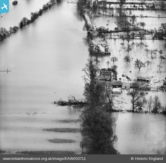
EAW003711 ENGLAND (1947). Eton Great Common under floodwater, Eton, 1947
© Hawlfraint cyfranwyr OpenStreetMap a thrwyddedwyd gan yr OpenStreetMap Foundation. 2026. Trwyddedir y gartograffeg fel CC BY-SA.
Delweddau cyfagos (2)
EAW003711

EAW023972

Manylion
| Pennawd | [EAW003711] Eton Great Common under floodwater, Eton, 1947 |
| Cyfeirnod | EAW003711 |
| Dyddiad | 18-March-1947 |
| Dolen | |
| Enw lle | ETON |
| Plwyf | ETON |
| Ardal | |
| Gwlad | ENGLAND |
| Dwyreiniad / Gogleddiad | 495581, 178439 |
| Hydred / Lledred | -0.62295402960121, 51.496318065118 |
| Cyfeirnod Grid Cenedlaethol | SU956784 |
Pinnau

Class31 |
Friday 13th of September 2013 11:06:32 PM | |
|
Class31 |
Friday 13th of September 2013 10:57:52 PM | |
|
Class31 |
Friday 13th of September 2013 10:56:16 PM | |
|
Class31 |
Friday 13th of September 2013 10:51:33 PM | |
|
Class31 |
Friday 13th of September 2013 10:50:21 PM |
Cyfraniadau Grŵp
Thanks for spending time on the image - we'll update the catalogue with the new information and post the updated record here in due course. Yours, Katy Britain from Above Cataloguing Team Leader |
Katy Whitaker |
Friday 1st of November 2013 02:51:30 PM |
Everything can be seen on the 1932 1:2500 Ordnance Survey map as seen on old-maps.co.uk |
Class31 |
Friday 13th of September 2013 10:53:57 PM |
Eureka We have another photo of the Eton Wick area looking east. |
Class31 |
Friday 13th of September 2013 10:49:31 PM |