
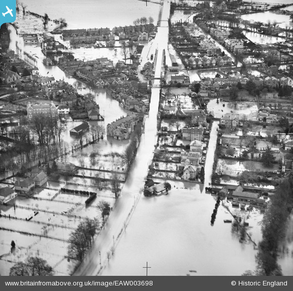
EAW003698 ENGLAND (1947). Flooding around Datchet Railway Station and The Green, Datchet, 1947
© Hawlfraint cyfranwyr OpenStreetMap a thrwyddedwyd gan yr OpenStreetMap Foundation. 2026. Trwyddedir y gartograffeg fel CC BY-SA.
Delweddau cyfagos (2)
EAW003698

EAW003701

Manylion
| Pennawd | [EAW003698] Flooding around Datchet Railway Station and The Green, Datchet, 1947 |
| Cyfeirnod | EAW003698 |
| Dyddiad | 18-March-1947 |
| Dolen | |
| Enw lle | DATCHET |
| Plwyf | DATCHET |
| Ardal | |
| Gwlad | ENGLAND |
| Dwyreiniad / Gogleddiad | 498561, 177123 |
| Hydred / Lledred | -0.58040234533126, 51.483975722999 |
| Cyfeirnod Grid Cenedlaethol | SU986771 |
