
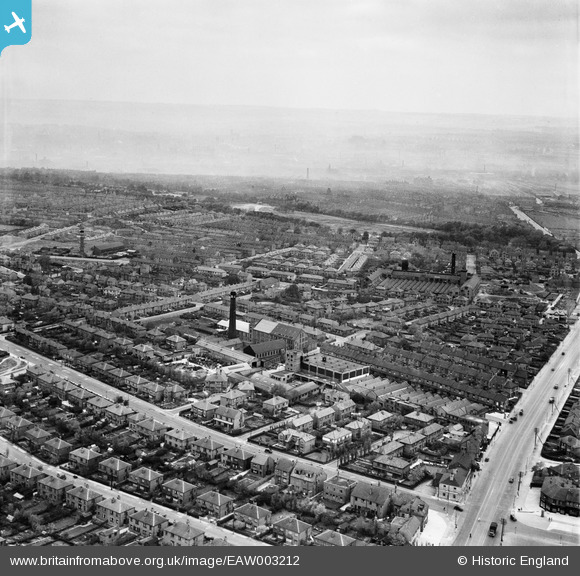
EAW003212 ENGLAND (1946). Residential streets surrounding Grove Hall Mills, Beeston, from the south-west, 1946
© Hawlfraint cyfranwyr OpenStreetMap a thrwyddedwyd gan yr OpenStreetMap Foundation. 2026. Trwyddedir y gartograffeg fel CC BY-SA.
Delweddau cyfagos (18)
EAW003212

EAW003207

EAW003215

EAW003214

EAW002618

EAW002620

EAW003210

EAW003217

EAW003213

EAW003211

EAW003208

EAW002619

EAW003206

EAW003218

EAW003216

EAW003209

EAW002617

EAW051499

Manylion
| Pennawd | [EAW003212] Residential streets surrounding Grove Hall Mills, Beeston, from the south-west, 1946 |
| Cyfeirnod | EAW003212 |
| Dyddiad | 18-October-1946 |
| Dolen | |
| Enw lle | BEESTON |
| Plwyf | |
| Ardal | |
| Gwlad | ENGLAND |
| Dwyreiniad / Gogleddiad | 428958, 430060 |
| Hydred / Lledred | -1.5606450655641, 53.765864203038 |
| Cyfeirnod Grid Cenedlaethol | SE290301 |
