
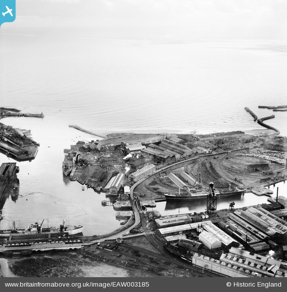
EAW003185 ENGLAND (1946). The Old Harbour, the North Basin and the Hartlepool Engine Works, Hartlepool, from the north-west, 1946
© Hawlfraint cyfranwyr OpenStreetMap a thrwyddedwyd gan yr OpenStreetMap Foundation. 2026. Trwyddedir y gartograffeg fel CC BY-SA.
Delweddau cyfagos (13)
EAW003185

EAW003186

EAW003191

EPW010608

EAW007972

EAW003192

EPW054633

EAW003203

EPW054634

EPW054635

EPW010609

EAW003190

EAW003187

Manylion
| Pennawd | [EAW003185] The Old Harbour, the North Basin and the Hartlepool Engine Works, Hartlepool, from the north-west, 1946 |
| Cyfeirnod | EAW003185 |
| Dyddiad | 23-October-1946 |
| Dolen | |
| Enw lle | HARTLEPOOL |
| Plwyf | |
| Ardal | |
| Gwlad | ENGLAND |
| Dwyreiniad / Gogleddiad | 451908, 533939 |
| Hydred / Lledred | -1.1944960887895, 54.697694707504 |
| Cyfeirnod Grid Cenedlaethol | NZ519339 |
