
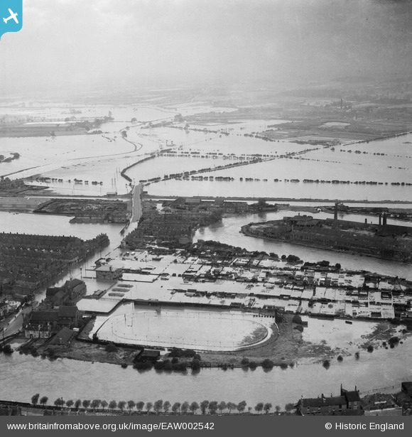
EAW002542 ENGLAND (1946). Flooded allotments next to the River Aire and flooded fields around Barnsdale Road, Castleford, from the south-east, 1946
© Hawlfraint cyfranwyr OpenStreetMap a thrwyddedwyd gan yr OpenStreetMap Foundation. 2025. Trwyddedir y gartograffeg fel CC BY-SA.
Delweddau cyfagos (6)
EAW002542

EAW002544

EAW002533

EAW002540

EAW002538A

EAW002534

Manylion
| Pennawd | [EAW002542] Flooded allotments next to the River Aire and flooded fields around Barnsdale Road, Castleford, from the south-east, 1946 |
| Cyfeirnod | EAW002542 |
| Dyddiad | 21-September-1946 |
| Dolen | |
| Enw lle | CASTLEFORD |
| Plwyf | |
| Ardal | |
| Gwlad | ENGLAND |
| Dwyreiniad / Gogleddiad | 443005, 426172 |
| Hydred / Lledred | -1.3480759301323, 53.729946491453 |
| Cyfeirnod Grid Cenedlaethol | SE430262 |
Pinnau
Byddwch y cyntaf i ychwanegu sylw at y ddelwedd hon!