
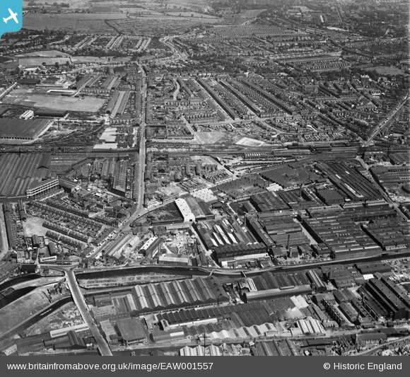
EAW001557 ENGLAND (1946). The Incandescent Heat Co Works, the Phillips Cycle Works and the surrounding residential area, Smethwick, 1946
© Hawlfraint cyfranwyr OpenStreetMap a thrwyddedwyd gan yr OpenStreetMap Foundation. 2026. Trwyddedir y gartograffeg fel CC BY-SA.
Delweddau cyfagos (21)
EAW001557

EPW057437

EAW001556

EAW001561

EPW057438

EPW057435

EAW014393

EAW001560

EPW057436

EAW001559

EPW057434

EPW057439

EAW014392

EAW014395

EAW014398

EAW014397

EPW057433

EAW001562

EAW014396

EAW014391

EAW014399

Manylion
| Pennawd | [EAW001557] The Incandescent Heat Co Works, the Phillips Cycle Works and the surrounding residential area, Smethwick, 1946 |
| Cyfeirnod | EAW001557 |
| Dyddiad | 10-July-1946 |
| Dolen | |
| Enw lle | SMETHWICK |
| Plwyf | |
| Ardal | |
| Gwlad | ENGLAND |
| Dwyreiniad / Gogleddiad | 403050, 289316 |
| Hydred / Lledred | -1.9550640778596, 52.50136995941 |
| Cyfeirnod Grid Cenedlaethol | SP031893 |
Pinnau

redmist |
Monday 26th of October 2020 11:44:53 AM | |

Sparky |
Friday 22nd of September 2017 10:18:37 PM | |

Class31 |
Thursday 27th of August 2015 09:31:07 PM | |
|
Class31 |
Thursday 27th of August 2015 09:29:27 PM | |
|
Class31 |
Thursday 27th of August 2015 09:28:07 PM |


Cyfraniadau Grŵp

Birmingham Canal from Rolfe Bridge, Bridge Street North, Smethwick, 12/08/2015 |
Class31 |
Thursday 27th of August 2015 09:28:54 PM |